new posts in all blogs
Viewing: Blog Posts Tagged with: Bens Place of the Week, Most Recent at Top [Help]
Results 1 - 25 of 27
How to use this Page
You are viewing the most recent posts tagged with the words: Bens Place of the Week in the JacketFlap blog reader. What is a tag? Think of a tag as a keyword or category label. Tags can both help you find posts on JacketFlap.com as well as provide an easy way for you to "remember" and classify posts for later recall. Try adding a tag yourself by clicking "Add a tag" below a post's header. Scroll down through the list of Recent Posts in the left column and click on a post title that sounds interesting. You can view all posts from a specific blog by clicking the Blog name in the right column, or you can click a 'More Posts from this Blog' link in any individual post.

Dear Place of the Week enthusiasts:
I’m writing you today with some sad news about the Place of the Week column. Ben Keene, Oxford’s geography editor and the founder of Ben’s Place of the Week, has left Oxford. For the last three years, Ben has done a superb job combing the globe in order to bring a particularly delightful, unusual, or timely locale to our attention, often with a humorous and graceful touch. I’m sure you share in my feeling that Ben’s love of geography has been contagious, and that the world now seems just that much smaller and friendlier to us all. The Place of the Week is now on hiatus and I will let you all know if we have the opportunity to start it up again in the future.
Safe travels,
Casper Grathwohl
Publisher

By: Rebecca,
on 1/20/2009
Blog:
OUPblog
(
Login to Add to MyJacketFlap)
JacketFlap tags:
Ben's Place of the Week,
atlas,
Washington D.C.,
Wall Street,
Hudson,
inagural,
Politics,
Current Events,
American History,
president,
Geography,
A-Featured,
Obama,
map,
Add a tag
Today the world turned its eyes to Washington, DC where the United States inaugurated its 44th President, Barack Hussein Obama. And while most of our executives have been sworn in here on the banks of the Potomac, our first head of state actually took office a stone’s throw from another river: the Hudson. On April 30, 1789, George Washington took his oath of office in front of a crowd assembled on Wall Street in lower Manhattan. After a long trip from his home in Virginia, he was rowed to New York and walked to Federal Hall, the site of his inauguration and the birthplace of American government. At the time, the city’s inhabitants numbered roughly 30,000, and its homes and businesses did not extend much further than the modern location of Canal Street. Just ten years later, the population of the country’s first capital had swelled to more than 60,000 residents.

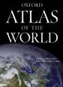
Ben Keene is the editor of
Oxford Atlas of the World. Check out some of his
previous places of the week.
Posted on 1/13/2009
Blog:
OUPblog
(
Login to Add to MyJacketFlap)
JacketFlap tags:
robots,
Japan,
Technology,
Geography,
A-Featured,
Ben's Place of the Week,
atlas,
Asia,
ben keene,
distribution,
Add a tag
Crack open just about any atlas and you’ll find at least one map of distribution: people, wildlife, minerals, places of worship, the density of all of these things can be plotted on the globe. And while observing small changes from year to year in these categories can be interesting and informative, I found the 2008 report published by the Statistical Department of the International Federation of Robotics particularly fascinating. Their Executive summary estimates a “total worldwide stock of operational industrial robots between a minimum of 994,000 units and a possible maximum of 1,200,000.” And they expect this already-impressive number to grow in the years ahead. So where are these robots you ask? Generally speaking, the answer is Asia, a regional production center for a wide range of manufactured goods. But the highest concentration is in Japan. Fully one-third of the total—a whopping 353,300 machines can be found here. In fact, the island nation has approximately 300 robots for every 10,000 people employed in manufacturing.
Ben Keene is the editor of
Oxford Atlas of the World. Check out some of his
previous places of the week.
By: Rebecca,
on 1/6/2009
Blog:
OUPblog
(
Login to Add to MyJacketFlap)
JacketFlap tags:
Geography,
alaska,
A-Featured,
Ben's Place of the Week,
atlas,
festival,
ben keene,
moose dropping,
Talkeetna,
Add a tag
Talkeetna, Alaska
Coordinates: 62 20 N 150 6 W
Population: 848 (2007 est.)
For those of us in the lower 48, the champagne toasts may already have faded from memory, but to Alaskans, the party’s not over yet. Why, you ask? Well, 2009 marks the fiftieth anniversary of statehood for the Last Frontier. Various events have and will take place across Alaska this year, but I’m wondering if anything special is being planned in the little town of Talkeetna. Located due North of Anchorage at the confluence of the Chulitna, Susitna, and Talkeetna Rivers, this settlement precedes Alaska’s official entry into the Union by about 40 years. And, as I’ve recently learned, they also hold a Moose Dropping Festival each summer which apparently culminates in a Moose Drop Dropping. Strange as it may seem, I didn’t make this up, and offer a quote from the Chamber of Commerce as evidence: “Shellacked and numbered moose poop is hauled up in the air in a net and then dropped on a bullseye. Raffle numbers correspond to numbers on moose poop. Winners include the closest and farthest from the bullseye. Sounds like not-much-fun but it is a highlight of the day!” Anyone looking for a heap of a good time in July?
Ben Keene is the editor of
Oxford Atlas of the World. Check out some of his
previous places of the week.
Posted on 12/23/2008
Blog:
OUPblog
(
Login to Add to MyJacketFlap)
JacketFlap tags:
Geography,
A-Featured,
maps,
map,
Prose,
quote,
Ben's Place of the Week,
ode,
Geographical Society,
George Bellas Greenough,
Add a tag
A founding member of the Geological Society of London, George Bellas Greenough also held the highest office in the Royal Geographical Society for two years in the mid-nineteenth century. In his presidential address to the professional body in May 1840, he offered his thoughts on the indispensability of maps. Given my own fondness for atlases, I’m posting an excerpt from his speech today:
Of all the contrivances hitherto devised for the benefit of geography, this [the map] is the most effective. In the extent and variety of its resources, in rapidity of utterance, in the copiousness and completeness of the information it communicates, in precision, conciseness, perspicuity, in the hold it has upon the memory, in vividness of imagery and power of expression, in convenience of reference, in portability, in the happy combination of so many and such useful qualities, a map has no rival. Everything we say or do has reference to place: and wherever place is concerned a map deserves welcome. There is scarcely one department of knowledge; physical or moral, beyond the sphere of its usefulness.
Honestly, I couldn’t agree more.
Ben Keene is the editor of
Oxford Atlas of the World. Check out some of his
previous places of the week.
By: Rebecca,
on 12/9/2008
Blog:
OUPblog
(
Login to Add to MyJacketFlap)
JacketFlap tags:
Business,
Geography,
A-Featured,
maps,
oil,
Ben's Place of the Week,
ben keene,
Khurais,
Oxford Atlas of the World,
Saudi Arabia,
Add a tag
Khurais, Saudi Arabia
Coordinates: 25 6 N 48 2 E
Estimated volume of oil: 27 billion barrels
The largest exporter of oil with over 20 percent of the world’s reserves, Saudi Arabia occupies roughly three quarters of the peninsula of arid land between the Red Sea and the Persian Gulf. As of 2007, this desert kingdom was producing approximately 11 million barrels of petroleum daily—an amount that could soon increase if all goes according to plan. Anticipating rising demand from Asia and wanting to exert more control over the market price for oil, the Saudis have lately intensified their efforts to tap into new fields. Khurais, east of Riyadh and roughly 150 miles from the Gulf of Bahrain, is one such project. Getting Khurais online does have its challenges however. In order to bring the light crude to the surface, tens of millions of gallons of seawater will have to be injected beneath the red sand dunes here. Nonetheless, experts predict that when finished, this massive cache will expand the nation’s production capacity by 1.2 million barrels a day.
Ben Keene is the editor of
Oxford Atlas of the World. Check out some of his
previous places of the week.
By: Rebecca,
on 12/2/2008
Blog:
OUPblog
(
Login to Add to MyJacketFlap)
JacketFlap tags:
floodgates,
Queen of Adriatic,
Current Events,
Geography,
A-Featured,
maps,
italy,
venice,
flooding,
Ben's Place of the Week,
atlas,
ben keene,
Add a tag
Venice, Italy
Coordinates: 45 27 N 12 21 E
Population: 69,361 (2008 est.)
Historically speaking, humanity has been quite successful at shaping the environment to suit our wants and needs. We’ve blasted through mountains, irrigated deserts, and altered the course of rivers. But sometimes sheer willpower and engineering aren’t enough. Venice, Italy is a case in point. Founded by Romans this city has grown to cover more than 100 islands in the Venetian Lagoon. The trouble is these small landmasses are low-lying and susceptible to flooding. Over the centuries, rising sea levels as well as water extraction from the mainland have caused the Queen of the Adriatic to gradually sink; yesterday news sources reported that Venetians were contending with water levels that rival previous records. Years ago however, city officials recognized that their problem would only become more serious, and in 2003 began a costly undertaking to protect their architectural heritage with 78 massive floodgates. Personally, I wonder about the long term consequences mobile barriers will have on the Mediterranean’s largest wetland area.
Ben Keene is the editor of
Oxford Atlas of the World. Check out some of his
previous places of the week.
Batman, Turkey
Coordinates: 37 55 N 41 5 E
Population: 246,700 (2005 est.)
I suppose in a world that seems obsessed with publicity and brand identity, it was bound to happen eventually. Apparently, in one of the stranger bits of news I’ve come across in the past few weeks, numerous sources reported that the mayor of Batman is actively considering filing suit against both Warner Brothers and director Christopher Nolan for using the name of the Turkish city without his consent. Central to the mayor’s argument is the fact that this city in the predominantly Kurdish part of southeastern Turkey was founded well before the creation of the crime-fighting Caped Crusader in 1939. Now, I have my doubts that this will amount to anything for the capital of Batman Province and the site of the country’s first oil refinery, but it has already led to plenty of jokes about other places that share names with movies and/or comic book characters. Maybe it’s just me, but I like to think that a little good-natured humor can help us learn geography too.
Ben Keene is the editor of
Oxford Atlas of the World. Check out some of his
previous places of the week.
Place of the Year will be announced next week. Anyone willing to guess what Ben will pick? In the meantime be sure to check out last year’s Place of the Year.
Ben Keene is the editor of
Oxford Atlas of the World. Check out some of his
previous places of the week.
By: Rebecca,
on 11/4/2008
Blog:
OUPblog
(
Login to Add to MyJacketFlap)
JacketFlap tags:
kids,
Education,
middle school,
Geography,
A-Featured,
maps,
visit,
Ben's Place of the Week,
atlas,
basic,
ben keene,
patchwork,
horizons,
grasping,
Add a tag
I’m quite fond of fall in New York, and as luck would have it, today is a lovely election day here in Manhattan. To be honest though, I’m finding it rather difficult to think about any map that isn’t a patchwork of red, blue, and maybe a splash of purple. So instead, I thought I’d write something about a visit I made to a sixth grade classroom last week.
At the end of the summer I was approached by a teacher in Brooklyn who was looking for someone to give a presentation about maps to her students. Curious to find out what these kids knew already and excited by the challenge of trying to teach them a little more about geography, I agreed to visit her school during my lunch hour. I discovered a few things while I was there: first (and I suppose this wasn’t really a surprise), our teachers have their work cut out for them. I did not have the full attention of her class much beyond the first 10-15 minutes, and the wide range of ability that I saw in just one period was daunting. I was both over-prepared (in terms of the amount of information I was ready to cover), and under-prepared (with respect to the difficulty some student had in grasping basic concepts). I talked about my job a bit, showed them six different types of maps, and encouraged them to ask lots of questions. Then, with about 30 minutes remaining, we attempted to walk them through the basic steps of creating a map of their own neighborhood.
I’m glad that I had an opportunity to visit New Horizons Middle School, and now that my feet are wet, I would actually like to talk to more kids about maps and geography. Because what I learned that afternoon is that our educational system has some room for improvement in this realm, and our children can’t afford to enter the adult world without some basic knowledge on the subject. As a colleague of mine likes to say: Without geography, you’re nowhere!
Ben Keene is the editor of
Oxford Atlas of the World. Check out some of his
previous places of the week.
ShareThis
By: Rebecca,
on 10/28/2008
Blog:
OUPblog
(
Login to Add to MyJacketFlap)
JacketFlap tags:
Geography,
A-Featured,
maps,
A-Editor's Picks,
guide,
Ben's Place of the Week,
atlas,
ben keene,
how to buy,
Add a tag
People like to ask me why they should bother with paper maps in our digital information age. I suppose that’s fair, reference information has been moving online with increasing rapidity. Well, call me old-fashioned, but my initial response is usually to point out that some basic map-reading skills can be quite handy, whether you’re a bibliophile or a tech junkie. As we’ve learned, implicitly trusting GPS technology can lead to some rather unfortunate consequences. The other question I get now and again is a little easier to answer: What makes an atlas worth owning in the first place? For the benefit of anyone who might be wondering about this, I thought I’d compile some simple guidelines.
- Two can be better than one
Know what you plan to use the atlas for—most of them are designed to deliver different types of geographical information. A US road atlas is essential if you’re on your way to the in-law’s for the first time, but less helpful if you’re trying to locate the principal wine-growing areas of the Eastern Mediterranean. That said, if you’re planning to drive around the Commandaria region on Cyprus, you might want to consult two atlases before booking a flight to Nicosia. In other words, consider using more than one atlas. If you’re currently atlas-less however, I’d start with a volume that maps all seven continents.
- Currency is key
You don’t have to be a demographer or an urban planner to know that the world changes every day. But with that attitude in mind, I recommend flipping to the copyright page right off the bat. Make sure the book you buy was published in the last five years. You should also read the fine print to find out when any statistical data in the atlas was last updated. Then leaf through it to see if recent major geo-political events are represented. Kosovo for example, declared its independence from Serbia this year, thus becoming the most recent nation to emerge from Yugoslavia’s dissolution. Oh, and if you find a page spread for South Asia with labels like “Hindoostan” and “Siam” on it, congratulations, you’re holding a rare book. However, unless you’re a collector, I’d say keep shopping.
- Count the maps (and pay attention to scale)
With all of the powerful online resources like Google Earth, a reference book is only as good as the sum of its parts—the more maps a book includes, the more useful it will be when you’re wondering how many autonomous republics Georgia has (it’s two). So take a minute and get a rough sense of the total number of maps. Is it 50 or 150? And don’t settle for a bunch of large-scale maps covering giant swathes of territory-be sure there is plenty of detailed cartography showing countries and cities too. By choosing carefully, you’ll end up with an atlas that isn’t just heavier and more expensive, but also more likely to have what you’re looking for. Really, if you’re going to fork over the money for a hefty new contribution to your library, you should get the most maps for your buck.
- Legibility counts
Good cartographers don’t try to cram every page with place names, relief contours, and dozens of tiny symbols. Maps are necessarily selective and a reader needs to be able to make sense of what they’re looking at. Color is important too. As Mark Monmonier writes in his excellent work How to Lie with Maps, “Persons unaware of the appropriate use of color in cartography are easily impressed and might accept as useful a poor map that merely looks pretty.” A few years ago a friend gave me a historical atlas that could have been great. Instead, upon browsing its contents I was confronted with one disappointing page after another: shading so bold it obscured the map features, clashing fonts, place names lost in gutters, and so on. Make sure your atlas isn’t just pretty.
- Don’t be sold on “fluffy features” alone
Oftentimes, atlases that have less in the way of comprehensive coverage mask this fact with an abundance of stock photography, geographic trivia, and slick design elements. Now personally, I appreciate a volume that can tell me Suriname’s GDP while also plotting the Trans-Alaska Pipeline, but let’s not forget that what we are after is quality cartography. Many atlas publishers now include fact books or gazetteers offering short summaries of countries and territories, but these features shouldn’t be the main attraction. And remember, a page cluttered with images leaves less space for the maps themselves.
- Consult the index
Last but not least, turn to the index. In essence, this element is basically the search engine for any work of reference. The more entries your atlas’s index has, the more layers of geographic information you’ll find on each page. And (bearing in mind my earlier point about legibility) that’s a good thing. Start by checking for a place that’s been in the news or has left you stumped lately. Is it there? How about historical names? If you didn’t know that—popular brands of gin aside—we’re calling Bombay Mumbai these days, would you still be able to find it in the index? And for those of you who want to use your new atlas in tandem with your favorite web mapping application, think about purchasing a book that lists latitude and longitude along with letter figure grid references in its index.
Ben Keene is the editor of
Oxford Atlas of the World. Check out some of his
previous places of the week.
ShareThis
By: Rebecca,
on 10/21/2008
Blog:
OUPblog
(
Login to Add to MyJacketFlap)
JacketFlap tags:
ben keene,
Tallahassee,
oblasts,
apalachee,
panhandle,
tipping,
territorial,
Geography,
A-Featured,
maps,
Florida,
twitter,
Ben's Place of the Week,
atlas,
Add a tag
Tallahassee, Florida
Coordinates: 30 27 N 84 17 W
Population: 156,612 (2004 est.)
Now that November 4th is just two short weeks off, tipping point states and swing states seem to be the only geographical units anybody wants to talk about. (Which, of course, differs from non-election years when everyone’s a-twitter about core areas, oblasts, and Exclusive Economic Zones.) In any case, I thought I would share a bit of trivia about the Sunshine State’s seat of government today. Located in the northwestern part of Florida known as the panhandle, this city had existed for well over 200 years before it was chosen to become the territorial capital in 1824. Until Spanish and then other European colonists arrived here, the Apalachee people inhabited the region. Conflict and disease soon reduced their population, but they left behind the name Tallahassee meaning “old town” or “abandoned fields.” During the American Civil War, Tallahassee was the only Confederate capital city east of the Mississippi River that Union troops didn’t capture.
Ben Keene is the editor of
Oxford Atlas of the World. Check out some of his
previous places of the week.
ShareThis
By: Rebecca,
on 10/14/2008
Blog:
OUPblog
(
Login to Add to MyJacketFlap)
JacketFlap tags:
Poland,
Geography,
park,
Ben's Place of the Week,
atlas,
ben keene,
Bialowieski National Park,
bialowieski,
belarusian,
wisent,
broadleaf,
bison,
capsule,
Add a tag
Bialowieski National Park, Poland
Coordinates: 52 43 N 23 50 E
Area: 25,946 acres (10,500 hectares)
Here in the US, all eyes are on the stock market and the upcoming election, two things that have caused people to brush up on their history, both economic and political. Since I happened across a geographic/natural time capsule of sorts this week, I thought I’d blog about it. Looking at a map of the world’s population distribution, you might conclude that Europe simply couldn’t possess any areas that have escaped change brought about by human activity. And yet, in westernmost Poland, along the Belarusian border, a primeval woodland supports trees that are many centuries old, as well as endangered animals such as the wisent, or European bison. So although it’s a relatively small part of a larger unprotected landscape, Bialowieski National Park stands today as one of the last sections of the old growth broadleaf forest that once covered much of the North European Plain. I find it truly remarkable that any virgin remnant exists after serving as a playground for Polish, Lithuanian, and Russian royalty, and then enduring two destructive world wars.

Ben Keene is the editor of
Oxford Atlas of the World. Check out some of his
previous places of the week.
ShareThis
Any guesses? I for one hope he is relaxing somewhere scenic. Mediterranean perhaps? Fear not though, he’ll be back next week.
Ben Keene is the editor of
Oxford Atlas of the World. Check out some of his
previous places of the week.
ShareThis
By: Rebecca,
on 7/29/2008
Blog:
OUPblog
(
Login to Add to MyJacketFlap)
JacketFlap tags:
atlas,
ben keene,
Kowloon Peninsula,
kowloon,
hong,
kong,
olympic,
peninsula,
overtaken,
replicated,
A-Featured,
Ben's Place of the Week,
china,
Reference,
lego,
Geography,
Add a tag
Kowloon Peninsula, China
Coordinates: 22 19 N 114 11 E
Area: 3.5 square miles (9 sq. km)
Before maps became a source of fascination for me, there was LEGO. Something about these multicolored, interlocking plastic building blocks sparked my imagination in way that other toys simply couldn’t. Ever since my enthusiasm for travel has overtaken my desire to construct miniature castles and Cubist dinosaurs, I tend to find cartograms and satellite imagery a bit more engrossing. Which doesn’t mean I wasn’t excited to discover Sport City, the latest creation of the Hong Kong LEGO Users Group (HKLUG). Using roughly 300,000 bricks and some 4,500 mini-figures, they have painstakingly replicated Beijing’s Olympic Village. Personally, I think their impressive achievement should be toured like the Olympic torch, but for now, it can only be seen by visiting Kowloon Peninsula, the densely populated spit of land across Victoria Harbor from Hong Kong Island.
Ben Keene is the editor of Oxford Atlas of the World. Check out some of his previous places of the week.
ShareThis
By: Rebecca,
on 7/15/2008
Blog:
OUPblog
(
Login to Add to MyJacketFlap)
JacketFlap tags:
marshland,
connie mack stadium,
philly,
shibe park,
lehigh,
shibe,
sportier,
baseball’s,
veteran’s,
baseball,
Oxford,
Geography,
A-Featured,
world,
maps,
Philadelphia,
stadium,
Ben's Place of the Week,
atlas,
ben keene,
Add a tag
Philadelphia, Pennsylvania
Coordinates: 39 57 N 79 5 W
Population: 5,687,147 (2006 est.)
With Major League Baseball’s All-Star Game tonight, and the end of the softball season for the Oxford Blues (OUP’s baseball team) looming next week, I decided to take a sportier slant with my post this week. But why Philly? Well, as it happens, the City of Brotherly Love was the site of the first steel and concrete baseball stadium in the United States. Shibe Park, which later became Connie Mack Stadium, opened its doors and entered the history books on April 12, 1909 as the home of the Philadelphia Athletics. Located north of the Central Business District and slightly east of the Schuylkill River between West Lehigh Avenue and West Somerset Street, this famous field hosted games until the end of the 1970 season. Fire damaged the structure the following year, and in 1976 it was finally demolished as that year’s All-Star Game took place across town on former marshland at Veteran’s Stadium.
Ben Keene is the editor of Oxford Atlas of the World. Check out some of his previous places of the week.
ShareThis
By: Rebecca,
on 7/8/2008
Blog:
OUPblog
(
Login to Add to MyJacketFlap)
JacketFlap tags:
A-Featured,
maps,
Ben's Place of the Week,
atlas,
ben keene,
hurricanes,
bahamas,
bertha,
great abaco island,
hurricane,
abaco,
november—tropical,
winds,
equatorial,
“hurricane,
Geography,
Add a tag
Great Abaco Island, Bahamas
Population: 14,000 (2005 est.)
Coordinates: 26 25 N 77 10 W
Think of the trade winds, steady equatorial air currents, and you might imagine early European explorers drifting across the Atlantic towards a cluster of lush islands strung across the Caribbean Sea like a necklace of pearls. But it is these same winds that also bring an annual average of six hurricanes to this region between June and November—tropical storms that are beginning to make the news once again. In fact, just yesterday, the National Hurricane Center announced that Bertha, the second named storm of the 2008 season, had graduated to Category Three on the Saffir-Simpson Hurricane Scale. So you’ll want to steer clear of Bertha, but if you’re searching for a “Hurricane Capital,” look no further than Great Abaco Island in the Bahamas; since 1851 it has endured 18 severe hurricanes (Category 3, 4, or 5) and 40 altogether which works out to about one every four years.
Ben Keene is the editor of Oxford Atlas of the World. Check out some of his previous places of the week.
ShareThis
By: Rebecca,
on 7/1/2008
Blog:
OUPblog
(
Login to Add to MyJacketFlap)
JacketFlap tags:
Geography,
A-Featured,
world,
Ben's Place of the Week,
atlas,
ben keene,
Niue,
South Pacific,
pacific,
coconuts—a,
offsetting,
niuean,
coral,
tonga,
importing,
Add a tag
Niue, South Pacific
Coordinates: 19 2 S 169 52 W
Population: 1,444 (2008 est.)
With an area slightly larger than Washington DC (about 260 square kilometers) Niue has the distinction of being one of, if not the largest coral island in the world. Located in the South Pacific east of Tonga and the International Date Line, it also has a unique tradition pertaining to the nut from which it takes its name. When a stranger of note first visits a Niuean village, it’s customary to present him or her with coconuts—a rather civilized and courteous gesture for a place formerly known as Savage Island. Niue relies heavily on economic aid from New Zealand and may well be the only territory in the world whose chief export is coconut cream. Unfortunately for the shrinking population though, neither this nor the other commodities sold to neighboring countries come close to offsetting the cost of importing over $9 million in food, manufactured goods, machinery, and fuel.
Ben Keene is the editor of Oxford Atlas of the World. Check out some of his previous places of the week.
ShareThis
By: Rebecca,
on 6/17/2008
Blog:
OUPblog
(
Login to Add to MyJacketFlap)
JacketFlap tags:
football,
baseball,
Geography,
A-Featured,
soccer,
stadium,
Vienna,
Ben's Place of the Week,
Ernst Happel,
European Football Championship,
Leopoldstadt,
“matzoh,
happel,
wurstelprater,
kugelmugel,
micronation,
Add a tag
Leopoldstadt, Vienna
Coordinates: 48 13 N 16 22 E
Area: 7.5 sq mi (19.3 sq km)
Having seriously played the sport for ten years in my youth, part of this time with a close friend from Belgium, I reached adulthood as a rarefied type of American: a soccer fan. By which I mean that I still haven’t figured out what all of those baseball statistics mean. But I am looking forward to June 29th when two teams will meet in Ernst Happel Stadium to decide the 2008 European Football Championship. Located in Leopoldstadt, one of 23 districts in Vienna, the stadium sits on an island created by the Danube Canal and the river of the same name. Historically this part of Austria’s capital contained a large Jewish population (Freud lived here), and because of this, gained the nickname “Matzoh Island.” A number of tourist attractions occupy the island today, including Wurstelprater, an amusement park, as well as the Republic of Kugelmugel, a micronation founded in 1984.
Ben Keene is the editor of Oxford Atlas of the World. Check out some of his previous places of the week.
ShareThis
By: Rebecca,
on 6/3/2008
Blog:
OUPblog
(
Login to Add to MyJacketFlap)
JacketFlap tags:
editor,
oxford,
Geography,
A-Featured,
keene,
Ben's Place of the Week,
atlas,
week,
ben keene,
places,
previous,
check,
Add a tag
Ben Keene is the editor of Oxford Atlas of the World. Check out some of his previous places of the week.
Arizona Strip
Coordinates: 36 50 N 113 0 W
Approximate area: 7,878 sq mi (20,404 sq km)
Last week I made my first visit to the Beehive State, or Utah as most of us know it, for some hiking, camping, and a bit of exploration via hybrid car. On Sunday, as I headed back to the airport, I decided to take a short detour to a region that the Bureau of Land Management includes “among the most remote and rugged public land in the lower 48 states.” Just over Arizona’s northern border, this two million acre swathe of sandstone mesas and ponderosa forest was covered in enough lush grass around the turn of the last century to support tens of thousands of cattle. Extensive logging and overgrazing reduced much of the land to desert scrub so while ranching persists here on the Arizona Strip, the number of animals isn’t nearly what it used to be. In fact, as I drove through the Kaibab Paiute Indian Reservation east of Fredonia, I saw little evidence of the human history that has unfolded here save for telephone poles, barbed wire fences, and rarely, a modest house.
ShareThis
By: Rebecca,
on 5/13/2008
Blog:
OUPblog
(
Login to Add to MyJacketFlap)
JacketFlap tags:
Oxford,
mexico,
myth,
Geography,
A-Featured,
map,
Ben's Place of the Week,
ben keene,
cibola,
cíbola,
pinpointed,
ciudades,
cíbula,
inexplicably,
coronado,
Add a tag
Cíbola
For several years now I’ve posted about regions that exist on maps, sites you could visit if you wanted to, places that can be pinpointed with latitude and longitude coordinates. I guess that’s why today I decided on a location fairly described as more myth than reality. In the sixteenth century, Spanish explorers bent on finding riches in the New World convinced themselves that there existed in what is now the southwestern United States, seven wealthy cities they collectively referred to as Cíbola, or less often Cíbula. Inexplicably setting out in the summer heat of 1540, Francisco de Coronado led the long march from Mexico to the area where he expected the cities to be. He was mistaken. “The seven ciudades are seven small towns, all consisting of the [rectangular stone] houses I describe[d earlier].” Of the seven, “each one has its own name, and no single one is called Cíbola,” he wrote in his account to the king of Spain. Today the Cibola National Forest and Grasslands encompass 2,213,591 acres of New Mexico, Texas and Oklahoma.

Ben Keene is the editor of
Oxford Atlas of the World. Check out some of his
previous places of the week.
ShareThis
By: Rebecca,
on 5/6/2008
Blog:
OUPblog
(
Login to Add to MyJacketFlap)
JacketFlap tags:
china,
Geography,
beijing,
Ben's Place of the Week,
lake,
yangtse,
polluted,
metropolises,
shanghai,
unchecked,
Add a tag
Tai Lake, China
Coordinates: 31 5 N 120 10 E
Approximate area: 930 sq. mi (2,409 sq. km)
As the opening ceremonies of the 2008 Summer Games have crept closer, China has scrambled to prepare Beijing, its capital city, for the fans, families, athletes, trainers, and dignitaries that will attend the Olympics in August. With an urban population topping ten million, dealing with pollution was one of the bigger challenges faced by organizers. But environmental contamination isn’t only a problem for the people living in and around the world’s major metropolises. South of Beijing and west of Shanghai, Tai Lake near the mouth of the Yangtse is one of the country’s largest freshwater bodies. It’s also heavily polluted. Once a scenic basin in a fertile agricultural region, Tai Lake has seen its beauty diminished by unchecked levels of human and industrial waste. Protests have compelled the government to take action, but the algae-choked water remains unfit for consumption.

Ben Keene is the editor of
Oxford Atlas of the World. Check out some of his
previous places of the week.
ShareThis
By: Rebecca,
on 4/29/2008
Blog:
OUPblog
(
Login to Add to MyJacketFlap)
JacketFlap tags:
History,
Germany,
Geography,
A-Featured,
Nazi,
camp,
map,
Ben's Place of the Week,
atlas,
Concentration Camp,
Dachau,
Munich,
memorials,
amper,
swelled,
crematorium,
bavaria,
attest,
Add a tag
Dachau, Germany
Coordinates: 48 15 N 11 26 E
Population: 40,570 (2007 est.)
The old village and sixteenth-century palace here attest to the fact that Dachau, located just north of Munich on the Amper River in Upper Bavaria, has been inhabited for centuries. In spite of such history however, it will forever be remembered as the site of the first Nazi concentration camp. When it was established in March 1933, the former munitions factory held just under 5,000 prisoners but in a little more than a decade, the population had swelled to more than 14 times that number. American forces liberated Dachau on April 29, 1945. Visitors who enter what remains of the walled camp today will find the foundations of numerous barracks, the crematorium, gas chambers, a museum in the main building, and numerous memorials scattered around the grounds.
Ben Keene is the editor of
Oxford Atlas of the World. Check out some of his
previous places of the week.
ShareThis
By: Rebecca,
on 4/15/2008
Blog:
OUPblog
(
Login to Add to MyJacketFlap)
JacketFlap tags:
Food and Drink,
Geography,
A-Featured,
maps,
keene,
ben,
mango,
Ben's Place of the Week,
atlas,
ben keene,
burma,
chin hills,
chin,
hills,
taxman,
mangos,
cashew,
pinpointing,
Add a tag

Chin Hills, Burma
Coordinates: 22 30 N 93 30 E
Maximum elevation: 10,018 feet (3,053 m)
Desperately trying to keep the Taxman at bay for a few more hours, I wound up at my favorite Monday night watering hole with a few friends last night, earnestly discussing the summer foods we enjoyed most. After listening to everyone’s peculiar arguments I found myself championing the mango as the perfect fruit for warmer days ahead. And yet as I tried to explain its versatility as an ingredient and its unrivaled popularity (the National Mango Board claims that more fresh mangos are eaten every day than any other fruit in the world), I realized that I knew precious little about its geographical origins.
As it turns out, this succulent relative of the cashew and the pistachio has been consumed in India for thousands of years, although it didn’t reach the United States until the late nineteenth century. Pinpointing the location of the first mango, when there are hundreds of varieties of the plant today, is not something I wanted to undertake but fortunately others had already agreed on the higher terrain forming the border between India and Burma (Myanmar). Running north-south, the evergreen-clad Chin Hills stretch across much of this tropical zone, and may hide an ancient progenitor in their forested slopes.

Ben Keene is the editor of
Oxford Atlas of the World. Check out some of his
previous places of the week.
ShareThis
By: Rebecca,
on 3/11/2008
Blog:
OUPblog
(
Login to Add to MyJacketFlap)
JacketFlap tags:
Film,
Geography,
A-Featured,
maps,
belgium,
keene,
ben,
Ben's Place of the Week,
bruges,
hitman,
caper,
hanseatic,
cobblestone,
zywn,
grit,
atlas,
Add a tag
Bruges, Belgium
Coordinates: 51 13 N 3 13 E
Population: 117,025 (2004 est.)
Earlier this month a new crime caper opened in theaters across the country with a rather unusual setting. Instead of a menacing metropolis teeming with villains and oozing with urban grit and gloom, director Martin McDonagh chose to shoot his film in the medieval Belgian city that appears in the title: Bruges. (more…)
Share This
View Next 1 Posts


Thanks for the acknowledgment Casper! It was an enjoyable assignment and one I’ll miss. For those web readers who find themselves in need of a daily dose of geography, travel, and a bit of wry humor for good measure, I’d encourage you to check out World Hum, a site I contribute to frequently.