Today is the conclusion of the 2014 FIFA World Cup, and our highlights about the final four competing nations with information pulled right from the pages of the latest edition of Oxford’s Atlas of the World. The final two teams, Germany and Argentina, go head-to-head on Sunday, 13 July to determine the champion.
Like many of its European neighbors, Germany is a country that loves football, and is one of the most competitive football-playing nations in the world. Attesting to that is their success in the semi-finals in this year’s Cup. Here are eight interesting facts you might not have known about the country that bruised Brazil’s ego.

- Like FIFA host country Brazil, Germany also elected its first female leader in recent years when Angela Merkel became Chancellor in 2005.
- In addition to bringing mankind the likes of Albert Einstein and Johan Gutenberg, inventor of the first printing press in Europe, Germany provides 20.6% of the world’s motor vehicles and 17% of our pharmaceuticals.
- Uranium was first discovered by a German chemist, Markin Klaproth, in 1789 and boasts the fourth largest industrial output (from mining, manufacturing, construction, and energy) in the world.
- Germany had a rough go of things for a while after World War II with its division into East and West factions, as well as the Cold War. The two were reunited on 3 October 1990 and adopted West Germany’s official name, the Federal Republic of Germany.
- Deutschland is a leading member of the European Union as well as the 17-member Eurozone, the economic and monetary union of nations that utilize the Euro as their sole form of currency.
- In terms of religion, Germany is mostly a Protestant and Roman Catholic country with a representation of 34% of the population.
- Although a leading producer of nuclear power (Germany ranks sixth in the world for 4.1% of global production), following the 2011 Fukushima disaster, the country has begun phasing out its nuclear power production.
- Germany is a primary refugee destination, ranking first in Europe and fourth in the world after Pakistan, Iran, and Syria.
Oxford’s Atlas of the World — the only world atlas updated annually, guaranteeing that users will find the most current geographic information — is the most authoritative resource on the market. The milestone Twentieth Edition is full of crisp, clear cartography of urban areas and virtually uninhabited landscapes around the globe, maps of cities and regions at carefully selected scales that give a striking view of the Earth’s surface, and the most up-to-date census information. The acclaimed resource is not only the best-selling volume of its size and price, but also the benchmark by which all other atlases are measured.
Subscribe to the OUPblog via email or RSS.
Subscribe to only geography articles on the OUPblog via email or RSS.
Image credit: Flag of Germany. Public domain via Wikimedia Commons.
The post Countries of the World Cup: Germany appeared first on OUPblog.

As we gear up for the third place finalist match of the 2014 FIFA World Cup today — the Netherlands face the host country Brazil — we’re highlighting some interesting facts about one of the competing nations with information pulled right from the pages of the latest edition of Oxford’s Atlas of the World. Germany (tomorrow’s country highlight) and Argentina go head-to-head on Sunday, 13 July to determine the champion.
The Netherlands, located in the western end of Northern Europe is widely known for its rich Dutch culture. The population is 83% Dutch, with a smaller percentage made up of Indonesian, Turkish, and Moroccan ethnicities. The nation has two official languages: Frisian, spoken mainly by inhabitants of the northern province of Friesland, and Dutch.
The country has a vast history, dating back earlier than the 16th century when it saw a multitude of foreign rulers including the Romans, the Germanic Franks, the French, and the Spanish. After building up a great overseas empire, the Dutch lost control of the seas to England in the 18th century, and were under French control until 1815. After remaining neutral through World War I, and being occupied by Germany in World War II, they went on after the wars to become active in West European affairs.
In 1957, the Netherlands became a founding member of the European Economic Community, now known as the European Union, and continues to be a leader in industry and commerce. Exports currently account for over 50% of the country’s GDP and include natural gas, machinery and electronic equipment, and chemicals. A highly industrialized country, it is also a major trading nation as it imports many of the materials their industries require.
With a constitutional monarchy, the Netherlands saw its Queen Beatrix abdicate the thrown in 2013 in favor of her son Prince Willem Alexander. She had served a 33-year reign.
Oxford’s Atlas of the World — the only world atlas updated annually, guaranteeing that users will find the most current geographic information — is the most authoritative resource on the market. The milestone Twentieth Edition is full of crisp, clear cartography of urban areas and virtually uninhabited landscapes around the globe, maps of cities and regions at carefully selected scales that give a striking view of the Earth’s surface, and the most up-to-date census information. The acclaimed resource is not only the best-selling volume of its size and price, but also the benchmark by which all other atlases are measured.
Subscribe to the OUPblog via email or RSS.
Subscribe to only geography articles on the OUPblog via email or RSS.
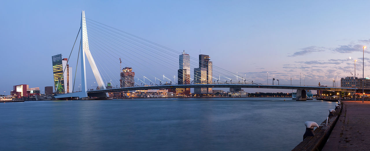
Image credit: A panorama of the Erasmus Bridge and the River Meuse in the Dutch city of Rotterdam. Photo by Massimo Catarinella. CC BY 3.0 via Wikimedia Commons.
The post Countries of the World Cup: Netherlands appeared first on OUPblog.

School might be out for the holidays, but there’s still lots to learn. Since education never ends, we’ve prepared this geography quiz drawn from facts from the Oxford Atlas of the World, 19th edition. The only atlas to be updated annually, Oxford’s Atlas of the World combines gorgeous satellite images with the most up-to-date geographic and census information.
Your Score:
Your Ranking:

Oxford’s Atlas of the World — the only world atlas updated annually, guaranteeing that users will find the most current geographic information — is the most authoritative resource on the market. The Nineteenth Edition includes new census information, dozens of city maps, gorgeous satellite images of Earth, and a geographical glossary, once again offering exceptional value at a reasonable price.
Subscribe to the OUPblog via email or RSS.
Subscribe to only geography articles on the OUPblog via email or RSS.
Image credit: From Atlas of the World, 19th edition.
The post Atlas of the World Quiz appeared first on OUPblog.

Since its inception in 2007, Oxford University Press’s Place of Year has provided reflections on how geography informs our lives and reflects them back to us. Adam Gopnik recently described geography as a history of places: “the history of terrains and territories, a history where plains and rivers and harbors shape the social place that sits above them or around them.” An Atlas of the World expert committee made up of authors, editors, and geography enthusiasts from around the press has made several different considerations for their choices over the years.
Warming Island was a new addition to the Atlas and conveyed how climate change is altering the very map of Earth. Kosovo’s declaration of independence not only caused lines on the map to be redrawn, but highlighted the struggle of many separatists groups around the world. In 2009 and 2010, we looked to the year ahead — as opposed to the year past — with the choices of South Africa and Yemen. Finally, last year was an easy choice as South Sudan joined us as a new country.
We took a slightly different tact with Place of the Year this year. In addition to the ideas of our Atlas committee, we decided to open the choice to the public. We created a longlist, which was open to voting, and invited additions in the comments. After a few weeks of voting, we narrowed the possible selections to a shortlist, also open to voting from the public.
Four front-runners emerged in both the longlist and shortlist: London, Syria, Burma/Myanmar, and Mars. These places have changed greatly over the years, but 2012 has been a particularly special year for each. London hosted the Queen’s Jubilee and the Summer Olympics, as well as the Libor scandal and Leveson Inquiry. The Arab Spring has spread across the Middle East and North Africa, but after the toppling of dictators in Egypt, Libya and Tunisia, civil war threatens to tear Syria apart. On the other side of the globe, the government of Burma (also known as Myanmar) is slowly moving to reform the country and only two weeks ago President Barack Obama made a historic visit to Rangoon. And finally, this August the Curiosity Rover landed on Mars. Although you can’t find Mars in our Atlas of the World (for obvious reasons), it captures the spirit of cartography: the exploration of the unknown and all that entails.
It was these four front-runners that we asked Oxford University Press employees to vote on and our Atlas committee to consider. Mars won the public vote, the OUP employee vote, and the hearts and minds of our Atlas committee.
Once we made our final decision on November 19th, we began contacting experts on Mars from around Oxford University Press to illuminate different aspects of the red planet. Inevitably, the first response we received asked us whether we had heard about the rumours surrounding NASA’s upcoming announcement. We took that as a good sign — and we’ll bring up An Atlas of Mars at our next editorial meeting.
Oxford’s Atlas of the World — the only world atlas updated annually, guaranteeing that users will find the most current geographic information — is the most authoritative resource on the market. The Nineteenth Edition includes new census information, dozens of city maps, gorgeous satellite images of Earth, and a geographical glossary, once again offering exceptional value at a reasonable price.
Subscribe to the OUPblog via email or RSS.
Subscribe to only geography articles on the OUPblog via email or RSS.


