


(See Part One Below)
After a few stops the day before for supplies, bear canisters and food, we were finally ready for our Mt. Whitney departure. A last minute flurry of e-mails, texts and phone calls confirmed the meet up place and time the next morning. We left Sacramento at 4:30 a.m. on Thursday, September 10.

Lone Pine, CA at the junction of Highway 395 and Whitney Portal Road.
The six-hour drive took us along highway 50 to the highway 89 turn toward Markleyville, then highway 88 to U.S. highway 395 south paralleling the Sierras. At 10:45 a.m. we pulled into the Lone Pine Ranger Station parking lot at 10:45 a.m., 15 minutes before lotto time.
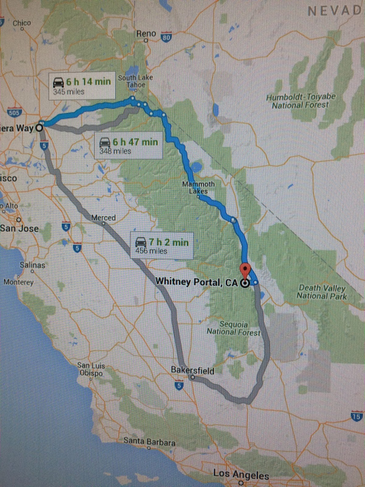
Driving route from Sacramento to Whitney Portal (Map image courtesy Google Maps)

High Sierras in 3-D (Model located in the Lone Pine Ranger Station)
The Ranger called one representative from each group forward. Nine numbers initially went into the bucket from which seven group leaders would randomly draw a number. Rob Fong from our group pulled lot number FOUR. When all lots were drawn, leaders/groups were called forward sequentially to claim their permits. As it turned out, numbers ONE and TWO were not drawn. So, our number FOUR gave us an excellent shot at a permit.
During our planning, we expected our best hope would be one overnight with “Next Day” entry onto the Whitney Trail. That meant we would have to find a “no permit required” place to sleep the first night, such one of the Cottonwood campgrounds at Horseshoe Meadows or even in the Whitney Portal parking area.
The next day, we would push as far as we could up the trail to an overnight trailside camp. The third day we would hike the rest of the way to the summit and all the way back down to Whitney Portal for our trip home. That was our plan. But plans are made to be changed based on more current information. And so it was.

Cottonwood campground at Horseshoe Meadows (Courtesy hikespeak.com)
When our turn came to request our permits, we asked for one overnight each if possible out of the “No Show” pool. As luck would have it, there had been 22 overnight “No Shows”. Because we were second in line, the Ranger offered us TWO nights on the trail! We could barely subdue our excitement as we nonchalantly accepted our gifted fate—far better than we had hoped. The only condition was a “Same Day” entry, meaning we were burning daylight the longer we stayed in the Ranger Station as we had to begin our hike up that same day rather than starting early the next morning. “OK. We’ll take it!”

Both day hiking and overnight permits must be visible on packs for a quick check by Rangers.
After the Ranger gave us our WAG bags (with instructions on how to carry out all solid waste) and reminded us to attach our permits to our packs, we were off. By the time we drove the 13 miles from Lone Pine to the Whitney Portal parking lot, tweaked our pack weight down a few pounds (given the excellent weather forecast) and hit the Trail, it was 1:45 p.m.

We entered the John Muir Wilderness around 2:00 p.m. and were above the tree line at around 10,000 feet by 5:30 p.m. We were optimistic but the sun was already dipping below the surrounding ridges and peaks. It would be another hour when we passed by Outpost Camp at 10,800 feet and 3.8 miles from Whitney Portal.

At the Whitney Portal Trailhead: Ike Krieg, Dennis Kazee, Rob Fong and Bill Kirk.

Dennis Kazee at the entrance to John Muir Wilderness.

Ike Krieg leading the way on the trail to Trail Camp.
It had been a hard 3,700 feet ascent to that level from the Whitney Portal Trail Head at 8,300 feet. After quickly setting up camp in the dark, we did little more that get a quick bite of dinner and collapse in our tents. Sleeping on granite (with a 1.5 inch Thermarest pad) was actually more comfortable than I thought. But due to the elevation change from sea level in Sacramento to 12,000 feet, sleep was fitful and there was a lot of breath catching going on all night in the thin air. We knew the next day we had another 2,500 feet of elevation gain and five more miles ahead of us. But somehow that didn’t sound too bad at the time. We were glad to finally get our packs off and find a flat place to pitch our tents.

At Trail Camp preparing for the ascent to the top (Photo courtesy Ike Krieg)
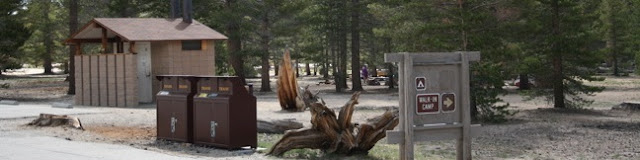
After a restless night, we were up at 5:30 a.m. to eat breakfast, filter water at a nearby tairn (small mountain lake) and load up our day packs with 3 liters of water and trail snacks.
Based on the Ranger’s advice, we left our tents open to any critters (marmots and chipmunks), knowing they would likely chew their way in otherwise. All food was stored in bear canisters placed 50 feet from our tents. By 8:00 a.m. we were on the trail toward the Whitney summit five miles ahead of us.
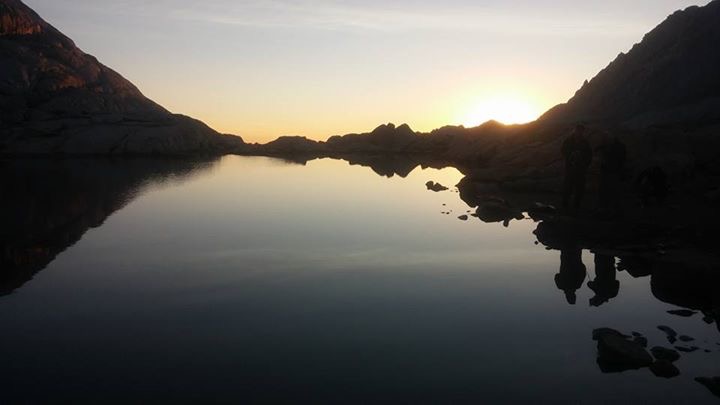
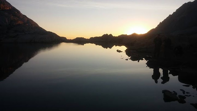
Trail Camp tairn at sunrise (Photo courtesy Ike Krieg)
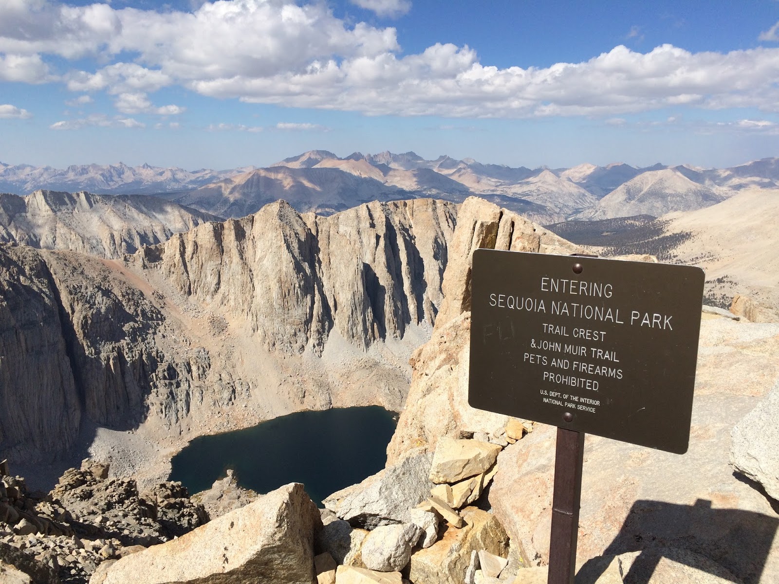
At Trail Crest looking toward Hitchcock Peak and one of the Hitchcock lakes.
Our slow, steady climb brought us to Trail Crest at 13,600 feet by 10:40 a.m. The trail was very well designed with only two or three spots where caution was warranted. Had the weather not been as good, the footing might have been more of a concern. But it couldn’t have been much better—luck of the draw.

Just beyond Trail Crest, a sign post announcing 1.9 miles to the summit was a mixed blessing—that relatively short distance translated to two hard hours of hiking the additional 900 feet of elevation gain.

Mount Whitney is just up the trail a piece--a couple more hours, that's all.
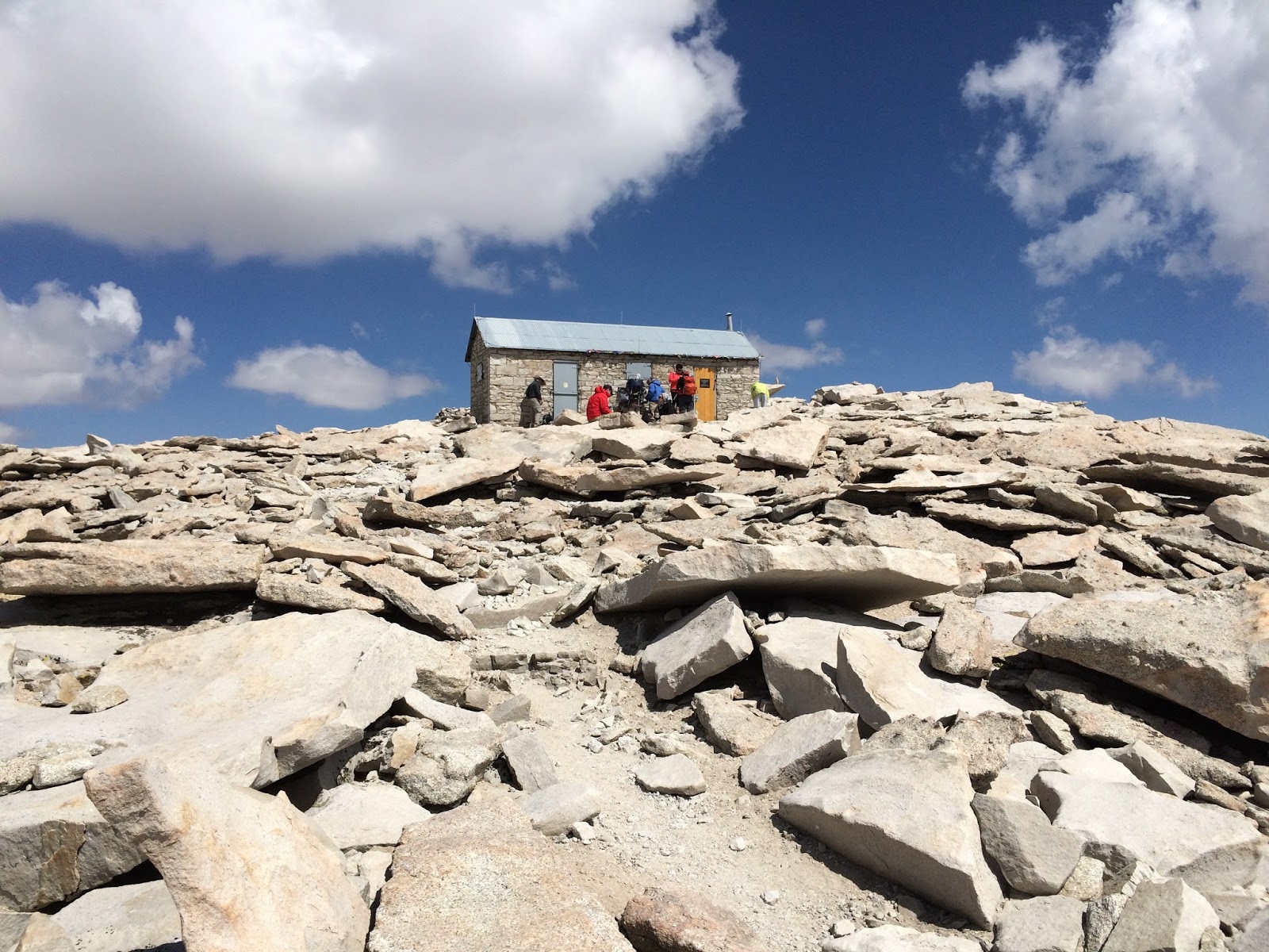
The final approach to the Stone Hut.
At 12:50 p.m. we reached the summit, took the obligatory photos and signed the record in a metal box outside the stone hut. For a brief moment, each of us was the highest human in the lower 48 states.

As billed, the views were remarkable and the top of the mountain didn’t disappoint. It had been a hard “up” but it was worth the effort. There was a growing chill in the wind—20 knots steady with frequent gusts of 25-30 knots. Clouds forming in the distance were a visible reminder that weather could change quickly in the High Sierras.

With some urgency, we started our slow retreat at 1:45 p.m., glad we had a second night on the trail. We reached Trail Camp by 5:30 p.m. with no sign of furry visitors or gifts left in our tents.

A few hours later, the scattered clouds which had been swirling near the peaks earlier in the day had moved on. There would be no rain that night and stars were brilliant with the Milky Way on its edge stretched like a cloud across the night sky. It wasn't until after dark, in the quiet of the evening, that we recognized the special significance of the date we had chosen to reach the summit: 9/11. Somehow, it seemed an appropriate way to mark the date.

The next morning, we woke early. Breaking camp was somewhat leisurely as we contemplated the six mile descent before us. Yes, it would be downhill all the way but it still took us over four hours. We left Trail Camp by 8:30 a.m., arriving at the Whitney Portal parking lot at 12:45 p.m.

Official survey mark at the top. In fact there were three or four of them....

Looking west from just below the peak on our way back down.

Sunset looking easterly from near Trail Camp.

Sunrise looking westerly from Trail Camp, illuminating the challenge between us and the summit.

Approaching the Whitney Portal parking lot and our ride back home (Photo courtesy Dennis Kazee).
Overall, our Whitney trek was indeed grand. But it was far from easy, even extending our time on the trail to three days. Recalling my Air Force Winter Survival training north of Spokane, WA near the Canadian border in 1970 and several more recent tests in the form of 50-mile ultra-marathons, this trek was among the hardest (if not the hardest) of physical experiences I have ever completed.
We had each put around 50,000 foot strikes on the trail to the summit and back down. The higher we went, especially above 12,000 feet, the shorter the time between brief stops to catch our breath. Without the training hikes in the weeks before our Whitney ascent, I’m not certain we could have made it.
We had each put around 50,000 foot strikes on the trail to the summit and back down. The higher we went, especially above 12,000 feet, the shorter the time between brief stops to catch our breath. Without the training hikes in the weeks before our Whitney ascent, I’m not certain we could have made it.

Rob Fong and Dennis Kazee on the trail.
Summiting Mt. Whitney is very doable in less time than we took. In fact, day hikers complete the 22-mile round trip in about 18-20 hours or more. Generally, they start at Whitney Portal at 2:00 a.m., reach the summit by noon and finish at Whitney Portal by 8:00 – 10:00 p.m. Almost half of their time on the trail is in the dark, which can be a bit dicey in spots. Personally, I would recommend at least one overnight on the trail—two if you are lucky.

Some bumper stickers you just can't pass up. Mt. Whitney elevation = 14,508 feet.
It was a long drive home but we were glad to have the time to decompress and reflect on what we had just finished and to recall the many hikers we had met from all over the U.S. and the world. Some were from places as far away as eastern Canada, Germany, France, Australia and Asia. The experience was definitely a high point. With a recovery week or two behind us, we are already imagining where the next adventure will take us....
Hike on! The trail beckons!
0 Comments on Mt. Whitney Or Bust! Part Two as of 1/1/1900
Add a Comment