NOW AVAILABLE! 30 Days to a Stronger Novel Online Video Course
- Paperback Book Available now.
- Video Course Available now.
- Kindle PreOrder Now
- Kobo ebook PreOrder Now
Two years ago, I wanted to write a story set in Campinas, Sao Paolo, Brazil.
I had never been there.
I only knew the name of two people who lived there.
Yet, I could convincingly write about the setting. Here’s the secret.
Google Earth
The free app, Google Earth, is immensely helpful to writers. I use the free, desktop version.
View satellite imagery, maps, terrain, 3D buildings, galaxies far in space, and the deepest depths of the ocean.
In 2011, Google Earth added the street view. They send out cars that drive along a certain road and take a 360 view of the landscape. That means you can put Google’s orange man on the street and look around. Today, the street view is available on all seven continents. See more on the background, scope and how to use Street View.
WhereisTheGoogleCar.com asks people to take a photo of the Google car when they see it and post the picture. It’s a “social experiment” to track the location of the car(s) on any given day.
Thank You, Google Earth, for Helping Me Write!
GPS Coordinates: Context.
When I wrote Abayomi, the Brazilian Puma, about a mother puma who died in a chicken coop trap near Campinas, Brazil, I was lucky enough to have an incident report that included GPS (Global Positioning System) coordinates. Google Earth immediately zoomed me into the right position, so that I was visually hovering right above the chicken coop. The context of the coop was crucial: Brazil has increased sugar cane production for use in making ethanol for automobile fuel, and the coop was nestled amidst the sugar cane fields. Pulling out some, though, it was also apparent that the sugar cane plantations were very close to large urban areas. This wasn’t a remote rural area. Instead, the pumas lived within sight of skyscrapers. How did I know this?
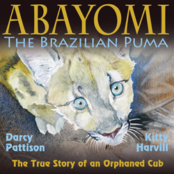
Abayomi was recently named a 2015 National Science Teacher’s Association Outstanding Science Trade Book.
Google Photos: Visual Details.
Google allows users to upload photographs that are marked with GPS information. On the maps, these are shown as tiny rectangles that when clicked open up the photos. Very near the chicken coop was such a photo that showed a skyline of skyscrapers of the city of Campinas.
Google Street Man and Maps: Topography
Google Earth also allows you to see the topography, or the terrain, of a setting. Is it hilly, flat, or somewhere in between? You can use the Street Man or simply fly around. We have a friend from India who flew us–through the miracle of Google Earth–over his parent’s house in the foothills of the Himalayas.
Distances: Measuring the Earth
I love the extra tools of Google Earth,too. For example, you can use the ruler to measure distances in kilometers or miles. I learned, for example, that a drone in a story would have to fly about 5 miles–as the crow flies. Very valuable information! I can then answer so many questions:
- Is that within a drone’s range? Yes.
- How long would the flight take, figuring 50 mph? 6 minutes.
That gives my hero a very narrow time window to locate the villain and disable the drone.
Other Options
Google Earth has in impressive area of other specialities: historical maps, Mars, the Moon, 3-D buildings, favorite places, maps about climate change and much more. See the range of services at their showcase.
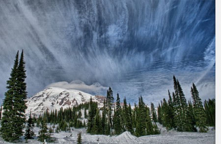
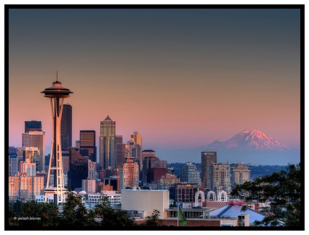
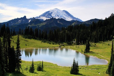
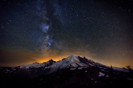
I’m researching Mt. Rainier for a story: through Google Earth, I’ve gotten context, followed trails, found fantastic photos, and almost feel like I’ve been there. No, I haven’t felt the wind on my face or heard the chatter of birds. I’m adding to the Google Earth info such things as the flora/fauna of the region. I’ve hiked other areas in the Pacific Northwest, and I’ve hiked in mountainous areas. I’m pretty confident that I’ll be able to recreate this landscape for a reader. It won’t hurt to have a beta reader from the area vet it for me, but I think it will be close. For me, Google Earth is the next best thing to being on-site myself. Add to that Flickr Photos that are Creative Commons licensed, and my story take on an added weight of reality.
(Click the photos to go to the original flckr.com sites.)