Media conglomerates export American culture throughout the world, but other countries often don't consume that culture in its intended manner. Here's a great example: a performance that took place yesterday at Carnival in Rio de Janeiro, Brazil.
Add a CommentViewing: Blog Posts Tagged with: hike, Most Recent at Top [Help]
Results 1 - 4 of 4
Blog: Cartoon Brew (Login to Add to MyJacketFlap)
JacketFlap tags: Cartoon Culture, Carnival, Brazil, Cheetara, Speed Racer, Muttley, Sonic the Hedgehog, The Flash, Ayrton Senna, Dick Dastardly, Penelope Pitstop, Speedy Gonzales, Add a tag
Blog: The Art of Phyllis Hornung Peacock (Login to Add to MyJacketFlap)
JacketFlap tags: boat, illustration, painting, Texas, squirrel, hiking, boat, Austin, hike, mangrove, drangonfly, mandolin, swamp, drangonflies, bull creek, hiking, Austin, hike, mandolin, mangrove, drangonfly, swamp, drangonflies, bull creek, Add a tag
At long last I have a new finished piece of art to post: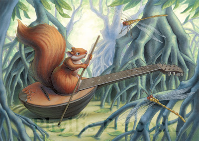 I suppose I'm reasonably satisfied with this piece. It seemed like it went a little smoother than usual and I managed to keep the paint fairly thin on the background which helps to cut down on time spent on the piece. What bothers me a bit is this isolated pool of red-orange that is the squirrel/boat. The warm yellow of the dragonflies was intended to balance out the orange of the squirrel, but I think they are too small to be as effective as I'd like. I did push some orange-ish color around in the background, but maybe not enough... All the same I think it came out okay.
Prints are in my Shop.
Not only hav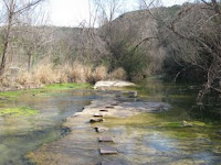 e I finally gotten back to painting, but we've also gotten back to our frequent w
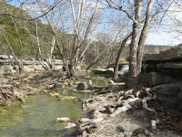 eekend hiking. We had a good long walk at nearby Bull Creek this past weekend. This trail was about three miles one way meandering back and forth across the wide creek. Where in LA we could clearly see the extremely parched condition of the land in the form of dry creek-beds and trickling waterfalls, here we could see the opposite - an abu
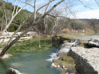 nda
nda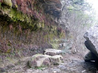 nce of water. We've heard the reason for this is that the soil's quite thin and underneath lies a layer of rock, so the water can't really soak into the ground and therefore channels into the many waterways that wind around the hills here. You can see how rocky the land is around the water in these pictures:
The trail 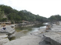 came to an end in a small dog park. I have never seen so many happy dogs together in one place at the same time. It was fun to watch them splashing around in the water so exuberantly. I think they had the right idea too - it was surprisingly warm that day and the water looked so inviting!
Blog: The Art of Phyllis Hornung Peacock (Login to Add to MyJacketFlap)
JacketFlap tags: tapia, california, hiking, malibu, los angeles, trail, hike, topanga, piuma, malibu creek, hiking, los angeles, trail, hike, topanga, malibu, piuma, malibu creek, Add a tag
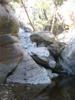
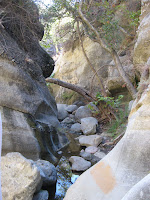
I know some time ago I mentioned that I could probably do a blog just about hiking and I guess I really wasn't kidding. So, because a good half of my blog focuses on hiking, I thought I'd add the word "hiking" to the subtitle. Anyway, my husband had the last week off work and I got absolutely no work done, but, naturally, we did do quite a bit of hiking . On Monday, we went to Topanga State Park and hiked the Santa Ynez Canyon Trail. The trail starts out high up in the hills and gradually winds down into a heavily wooded canyon. Taking a left at a fork in the trail, the path leads to a waterfall. We strayed off the beaten path a bit and followed the stream, boulder-hopping to reach the waterfall. At one point in the creek, the boulders are just high enough that we needed to use some knotted ropes that had been left there to help pull ourselves up to higher ground. The waterfall was no more than a trickle just like every waterfall we've encountered this summer, but unlike the many creek-beds we've seen, this one did run with water.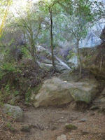
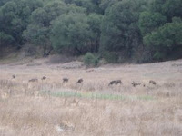
 Taking the same trail, we made our way back to the car. As we came over the crest of the last hill, the land opened out into dry, grassy meadows. We spotted a lone deer grazing not too far away. I tried to get as close to it as I could without alarming it, shooting pictures along the way. When that deer disappeared from view, we continued on our way, but stopped again shortly when we heard something sizeable crashing through the brush. Another deer came into view! And another and another - a herd of eight deer in all wandered out from the cover of forest into the open
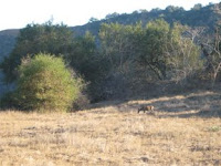 meadow. We shot many photos, but the deer were so well camouflaged that they are difficult to see in the photos. When they finally slipped out of view, we made our way through a live oak grove back to the car. We'd been so tired from the long hike, but after we paused and watched the deer for a while we felt energized all over again. It's so exhilarating to see wildlife in their natural habitat.
Malibu Creek
On Friday we went hiking again, this time we started out at the parking lot for Piuma Ridge. There seemed to be endless little side-trails that led to who-knows-where. We made our way north, entered into a smallish live oak grove, and got a glimpse of a water reclamation facility. After nosing arou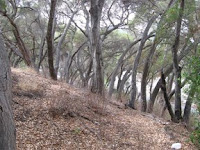 nd for
  a bit, we decided to try to find our way through Tapia Park and into Malibu Creek State Park, intending our final destination to be the Mott Adobe Ruins. We took a trail that seemed logical, but turned into a dead-end at a locked gate. So we had to double back, find a trail not marked on the map and carefully pick our way across a narrow strip of the creek. We had
  made it into Tapia and ended up hiking right next to a long road/parking lot which then ended abruptly at a camp. According to the map we had, the camp appeared to have been plunked down right in the middle of the road we wanted to take and of course it was gated, so the desirable road was completely off-limits. We were so lost we even asked for help. Unfortunately the person we asked wasn't all that familiar with the trails, so we took a guess at which trail to take. And we guessed right! We took a segment of the Backbone Trail that traversed up the side and over a mountain right into Malibu Cre
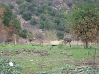
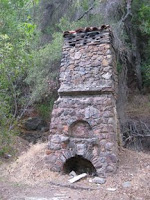 ek State Park. Not too far into the park, we spotted six deer grazing on a patch of green grass. We were as close as we'd ever been to the creatures and shot a lot of photos. The buck seemed to become a bit unnerved by us and bounded gracefully away across the road. It was as if he was telling his herd that he wasn't terrified, but thought it best to move on. The rest of them seemed unperturbed, but gradually followed him. We did finally come across the Mott Ruins. There wasn't much left of them, save the chimney. It seemed a bit of a disappointment after spending much of the day being lost in trying to find it. On the way back we crossed a broad meadow were a whopping fifteen deer were grazing. This sight alone made the trek well worth while!
Temescal Canyon
So then yesterday we went back to Topanga State Park and hiked Temescal Canyon Trail which is on the southern side of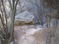 the park in Malibu. It was a really beautiful location, but it was just full of people - probably the most we've ever encountered during a hike. With all the people there was no chance of encountering wildlife. The trail leads out to a meager California waterfall and then loops back to the parking lot switch-backing along a mountainside. At the top of the mountain, there's a path that traverses the ridge and ends at Skull Rock. Usually look-out points in these various parks offer sweeping views of the ocean or more mountains, but this trail featured views of the city. Very pretty, but a bit too busy.
On a more artistic note, last night we watched the anime movie Tekkonkinkrete. Even if you're not really into anime it's definitely worth a watch for the backgrounds alone. They are just stunning. I would never in a million years have the patience to paint such amazingly detailed backgrounds. Wish we'd caught it on the big screen...
Read the rest of this post
Blog: The Art of Phyllis Hornung Peacock (Login to Add to MyJacketFlap)
JacketFlap tags: hiking, malibu, hiking, los angeles, trail, hike, malibu, Point Mugu, los angeles, trail, Point Mugu, hike, Add a tag
I know I just wrote in my last post that we weren't going to go to Point Mugu until October so we could catch the sycamores in their full glory, but we've sort of run out of coastal parks to visit, so this past weekend we caved in hiked part of Point Mugu. It's gradually getting cooler, but it's still just warm enough to prevent us from doing some of the more inland hiking. Fortunately, Point Mugu is a huge park, so we'll likely come back to hike more of the trails and maybe we'll get another glimpse of the sycamores.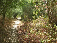
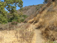
So we started up Big Sycamore Canyon Trail, thinking we'd try to keep to the shade that canyon trails usually offer and then we took a right a a fork in the path onto the Serrano Canyon Trail. It was a good choice as the trail was heavily wooded for a long way and offered much shade. Eventually, the trail 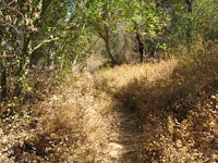
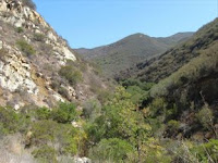 winds up out of the canyon and opens onto a vast, grassy meadow surrounded by mountains on all sides.
I generally think that I prefer hiking through woods, but I always find myself so contented trekking through open grassland li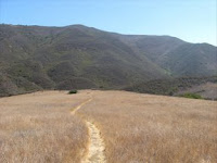 st
st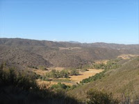 ening to the wind rustle through the dry grass - it's one of my favorite sounds.
The trail began to climb up out of the valley, back into the mountains. We took a left at another fork in the road, thinking this narrow path would take us back to the main fire road. As it turned out, we were very much off-the-beaten-path on what resembled a deer path cut through dense short, woody trees. My bare arms took quite a lashing from those dry branches. A machete would have been very handy at this point! We continued on the trail despite misgivings just to see where it would take us and ended up on a promontory with a great view, but no way down to the fire road. So we had to make our way back through the brush to the more well-worn trail. After quite a bit more trekking we made it back to the fire road. We still had another two or three miles to go to get back to the parking lot and we were pretty tired already. But, at least the fire road was pretty flat - no major hills to climb. I think this was our longest hike yet. I'm estimating it at seven or eight miles. We were really feeling it by the end! I really liked this park - maybe we'll come back and hike a little more of it next weekend!


